Mary’s Rock is among the most popular hikes at Shenandoah National Park, boasting views across the Shenandoah Valley and Massanutten Mountain.
Two hikes lead to the rocky summit, including a moderate 2.7-mile out-and-back hike that starts across from the Meadow Spring parking area on Skyline Drive.

There is also a 3.7-mile out-and-back hike that starts at the Panorama parking lot. Both routes take the Appalachian Trail to the top of this 3,514 foot tall peak.
I’ve hiked both and wanted to share what’s to love about each hike, so you can decide which hike is for you. Either way, you’ll win with gram-worthy panoramas.
Mary’s Rock Hike #1 (Southern Approach)
This 2.7-mile hike begins at milepost 33.5. Arrive early to secure a spot in the Meadow Spring parking area on the east side of Skyline Drive.
There are 12 parking spots, including nine pull-in spots and three parallel spaces. However, it is also possible to parallel park along the two-lane scenic byway.

The Meadow Spring parking area also serves those hiking the blue-blazed Buck Hollow Trail and the yellow-blazed Hazel Mountain Trail.
Carefully cross over Skyline Drive, then look for a concrete trail marker and blue blazes that set you off in the right direction toward Mary’s Rock.
Meadow Spring Trail
From the marker, hike a short and steep .6 miles on the Meadow Spring Trail. This blue-blazed hiking trail connects with the white-blazed Appalachian Trail.
Wooden steps built into the trail make the climb more manageable, particularly for young children and new hikers.

About half-way along the shaded Meadow Spring Trail, you’ll see an intriguing old stone chimney.
It’s all that remains of a former home owned by one of more than 450 families that lived within the boundaries of the park in the 1930’s and 1940’s.
Meadow Spring
At this point, you will also be steps from the namesake spring. Once you reach the Appalachian Trail, you’ll continue along another .75 miles to reach the summit.
Just before the final steps to the summit, the trail connects with the northern approach trail, guiding hikers coming from both directions to Mary’s Rock.

As the trees and greenery open up at the top, get ready to be awed by the spectacularly scenic views on one of the most scenic Skyline Drive hikes.
Look out into the valley from the overlook or climb high up onto Mary’s Rock for more outstanding panoramas. I arrived as low clouds were rolling into the valley.
Re-trace your steps to the parking area. Pay attention. After .1 miles the spur trail ends. Turn right to proceed southbound on the Appalachian Trail.

Mary’s Rock Hike #2 (Northern Approach)
This 3.7-mile hike begins at the back of the Panorama parking lot at milepost 31.6 on Skyline Drive. It’s a stone’s throw from the Thornton Gap entrance.
There are at least 50 parking spaces at Panorama, as well as restrooms. A large trail kiosk is located at the back of the lot, adjacent to the trailhead for this hike.

From the trail kiosk, proceed on a very short spur trail that guides you to the white-blazed Appalachian Trail. Turn left to begin your trek to the summit.
In a few more steps, a quick dozen or so wooden steps built into the trail make the ascent more manageable, particularly for children.

As you make your way along the trail, you’ll see some large rocks here and there along the right side of the trail that are fun for kids and adults to climb on.
At the 1.0-mile mark, a nice-size opening on the left allows for far-reaching mountain vistas, as well as delightful bird’s-eye views of Skyline Drive.

Press on and the trail connects with the southern approach trail at the 1.7-mile mark, guiding hikers coming from both directions along a spur trail to Mary’s Rock.
Stay right to continue along the blue-blazed trail to the summit. As the trees and greenery open up at the top, get ready to be awed by very big views.

From the summit, look out into the Shenandoah Valley from the rocky overlook or climb high up onto Mary’s Rock for even more far-reaching panoramas.
This is a great place to stop for a water break and a snack. Take a seat and savor the views. When you’re ready (don’t rush), re-trace your steps to the parking area.

Wrap-Up Notes
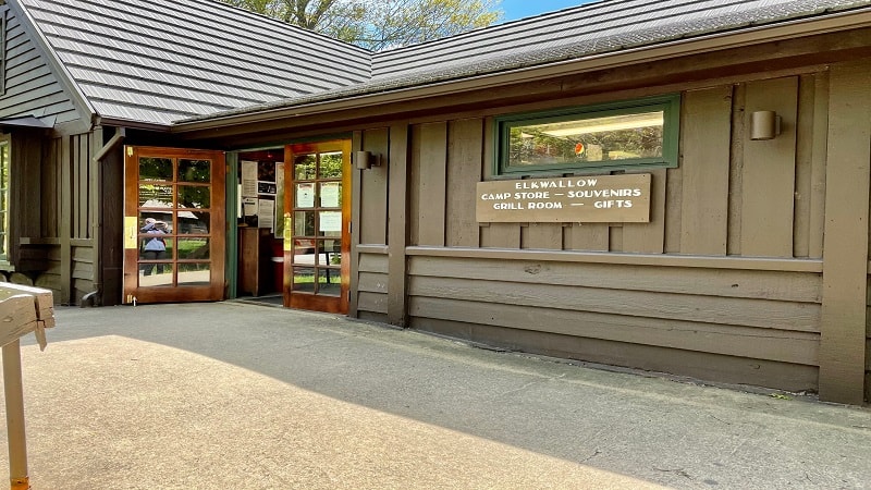
For those eager to re-fuel post-hike at or near Shenandoah National Park, consider Elkwallow Wayside at milepost 24.1 on Skyline Drive (open seasonally).
At Elkwallow Wayside, you’ll find groceries, camping supplies, souvenirs and grab-and-go sandwiches. There is also a restroom and a picnic area.

If you want to grab a bite outside the park, look to Sperryville Trading Market & Café. They have take-out service, but you can also eat on the café’s front porch.
Before you arrive, keep your eyes open for one of the iconic LOVEworks. It will turn up on the right and is perfect for a quick snapshot.
If you want to see what the Mary’s Rock hike looks like before you go, take a look at this short video I created when I hiked to the summit.